Photo retakes from the Lake Isabella area, Kern County, CA, April 20 & 21, 2015
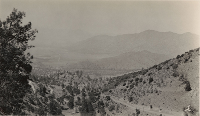
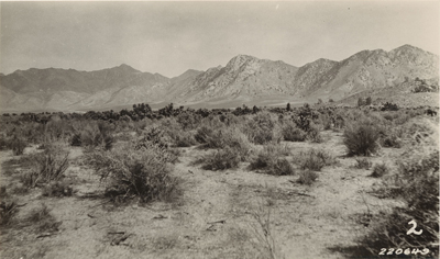
The original images were taken in 1927 by Albert E. Wieslander (1st image) and L.M. Correll (2nd and 3rd images).
The images are part of the Wieslander Vegetation Type Map (VTM) collection.
|
|
|
|
View from Caliente Bodfish Road, above Bodfish. Lake Isabella is in the distance, on the left, in the 2015 image.
Thanks to a fellow we talked to at Nelda's Diner, we were able to find this site. I thought the image had been taken from Caliente Bodfish Road, but didn't drive far enough up it on the first attempt. It was a scary road on which to stop. Photo details: CalPhotos Lat/long: 35.57290, -118.50651 High resolution: image
|
|
|
|

|
|
|
|
|
View from vicinity of the BLM building off Highway 178, east of Onyx.
(Not sure what is going on with the hill on the right -- maybe the photo location is off, the hill is gone, or the hill is somehow not visible in my images.) Photo details: CalPhotos Lat/long: 35.72772, -118.13745 High resolution: image
|
|
|
|

|
|
|
|
|
View of Lake Isabella from Sierra Way, before and after the lake was created. In 2015, the drought has severely reduced the amount of
water in the lake, affecting boating and recreation in the area.
At Paradise Cove, the lake is gone and the lovely, curved shape of the river is visible. In other areas of the lake, dead trees above the water level make the lake difficult for boating. Photo details: CalPhotos Lat/long: 35.68598, -118.42728 High resolution: image
|
||
|
July 1927
|
June 2013
|
April 2015
|
[See also a March 2015 update from Walker Pass.]