Download zip file of high res images here.
|
|
|
|
Photo details: CalPhotos
Lat/long: 35.70679, -118.42317
High resolution: image
One may be able to get this view without the plowed field by accessing park/public land just a bit north of where this was taken from, and driving on a dirt road to get to a spot behind (west of) this property. Note that the caption says "near Kernville" -- but the nearest town as the crow flies is Wofford Heights. Kernville has MOVED since this photo was taken in 1927, to make way for the lake after the Kern River was dammed. From wikipedia: "After decades of planning, the Isabella Dam project began in 1948. As a result, Kernville was moved upstream to its present location at the tip of the northeast fork of the man-made lake. ... The town's original location is slightly east of Wofford Heights. Foundations and such can still be seen when the lake is low." |
|
;)
|
;)
|
|
|
|
|
Photo details: CalPhotos
Lat/long: 35.68598, -118.42728
High resolution: image
Site of what is now Lake Isabella. |
|
;)
|
;)
|
|
|
|
| Photo details: CalPhotos Lat/long: 35.69483, -118.21915 High resolution: image | |
;)
|
;)
|
|
|
|
|
Photo details: CalPhotos
Lat/long: 35.66348, -118.03816
High resolution: image
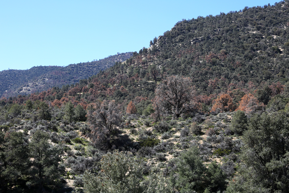
This shot was taken from the Walker Pass Campground. It's in Kern County, not Tulare as the caption says. UPDATE March 2015: I had an unexpected stop at Walker Pass in March, 2015. I thought everything would look the same as it did in 2013, but it didn't. There were lots of dead and dying pine trees! I didn't have the Walker Pass VTM photo with me, and there was no cellular service at Walker Pass (to view the original online and remind myself how exactly it was framed), but I took some photos which I then cropped at home. Here is a retake from 2015. And here is a shot of the view just to the right of the original VTM image, where you can see more brown, dead pines. The area around the Walker Pass campground had many dead pines as well. |
|
;)
|
;)
|
|
|
|
| Photo details: CalPhotos Lat/long: 35.87231, -118.01729 High resolution: image | |
;)
|
;)
|
|
|
|
|
Photo details: CalPhotos
Lat/long: 35.98844, -118.07988
High resolution: image
Original photo was probably taken a few yards away from the road, but there was a barbed wire fence in the way in 2013. |
|
;)
|
;)
|
;)
;)
;)
;)
;)
;)